For three weeks (and one day), we have had to write down information about the weather. Mostly, I thought it was very tedious. Everyday we recorded the high and low temperature, the barometer, the wind speed, the wind direction, the sky coverage, the precipitation (if any), and the amount of precipitation (if any). Since I'm not a natural-born weather forecaster, so I went to www.forecast.weather.gov or, as it's more commonly known as, NOAA. this came in handy because I could get all the information I needed to fill out my weather chart. I also figured out that there was a three-day weather history archive at this site too in case I forgot to get the weather for a day.
Later when I reviewed the whole chart I saw that we had some form of precipitation for more that a third of this three week time period. Also we mostly had cloudy days although there were a lot of sunny days too. Lastly the average high was 59 degrees Fahrenheit and the average low was about 34 degrees Fahrenheit.
Friday, April 18, 2008
Tuesday, April 15, 2008
Activity #5 - Wind Patterns
Today we learned that there are wind patterns that control the weather on the Earth. They also create the ocean currents too. With out them we wouldn't have trade winds or ocean currents such as the East Atlantic current . These wind patterns also determine where hurricanes and other storms at sea will travel and how much of an impact they will then have. In the North Pole these winds always travel in a circular motion to the right. They also do this in the South Pole too and these winds are responsible for the Polar Circulation. I found this helpful because I will need this information to relate how my climate is effected (and in turn effects places like Michigan).
Thursday, April 3, 2008
Activity #4 - Atmospheric
Today in class we graphed the results of atmospheric temperatures. We simulated cloud coverage (the bottle's tops were painted white) versus non cloud coverage (bottle's tops were left clear) over land (soil), sea (room temperature water) and snow (white sand). Typically the bottles with the white-painted tops were of course lower in atmospheric temperature except for the bottle of white sand that was painted white. It was higher in temperature that it's counterpart and also rose increasingly faster. But it finally leveled off just under it's counter part. I attribute this to the inconsistency to the differences in the levels that the thermometers were placed in the "atmospheres". This experiment helped me see how atmosphere and cloud coverage would affect my climate.
Tuesday, April 1, 2008
Why is Mother Nature Playing A Cruel Trick on April Fools?
In class today we discussed the present global weather conditions and how they were effected by three dominant conditions. These conditions are: Moderate La Nina Conditions, Strong Polar Circulation, and the Divided North American Jet Stream.
The La Nina is a cold ocean current that occurs in the Pacific Ocean. This ocean current is responsible for colder and longer winters in the U.S./Midwest area and all-around colder, lower-than-average summers too. El Nino as you can guess is another Pacific Ocean current but it is a warm ocean current. But it is obvious to see that this year we have La Nina occurring which explains the harsher, colder winter that us Michiganders have experienced and the predictions of a colder summer.
Strong Polar circulations also have been a bad side effect of the La Nina cold ocean current. Which has resulted in colder winds that have been bringing on the heavier snow storms that have been dumped in Michigan to make a record-breaking year of snow fall, not seen since 1900.
Lastly, the divided North American jet stream (also partly caused by La Nina) has forced colder wind currents from the polar circulations down on the Midwest and Great Plains areas. It also has forced precipitation from the gulf of Mexico up into the Midwest to cause more accumulated snow fall. This will make for a colder summer in the Midwest, and a drier summer in the Great Plains which won't make for a good crop yield for this year!
Activity #2 - Atmospheric Moisture Advection and Precipitation
In class we did an activity on how the earth's moisture effects the weather patterns and year round weather. We learned that the wind patterns of the world determine where and how much of the precipitation in the clouds above will be distributed/dumped on the U.S. In places where it is warmer, more bodies of water are evaporated and held in the clouds to distribute to other places when it condenses. If the wind current are strong enough, the precipitation gathered from from the gulf of Mexico can be pulled up and later deposited in Michigan in the form of intense showers or snow storms.
Friday, March 28, 2008
Activity #1 - Atmospheric Precipitation
At the beginning of activity #1, I thought that it was pointless to do and I didn't think I was going to learn anything from it. We had to observe the heating and cooling affects of snow, water and soil at ten minute intervals. As the activity progressed, I was interested to observe how water stayed at 18 degrees Celsius during the entire heating and cooling process. Soil started at 19.6 degrees Celsius and continued to rise to 20.2 degrees Celsius by the end of the heating cycle. It shocked me when I observed it to continue to rise to 20.6 degrees Celsius by the end of the cooling cycle...I thought it would have decreased in temperature! Following suit with the soil, the snow rose from 0.2 degrees Celsius to 0.4 degrees Celsius by the end of the heating cycle and continued to rise to 0.5 degrees Celsius by the end of the cooling cycle.
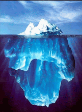
Since my climate project will be on how the melting ice caps will effect the surrounding climate, I found that the heating and cooling effects of snow will greatly help me in my understanding of its properties.
Since my climate project will be on how the melting ice caps will effect the surrounding climate, I found that the heating and cooling effects of snow will greatly help me in my understanding of its properties.
Subscribe to:
Posts (Atom)